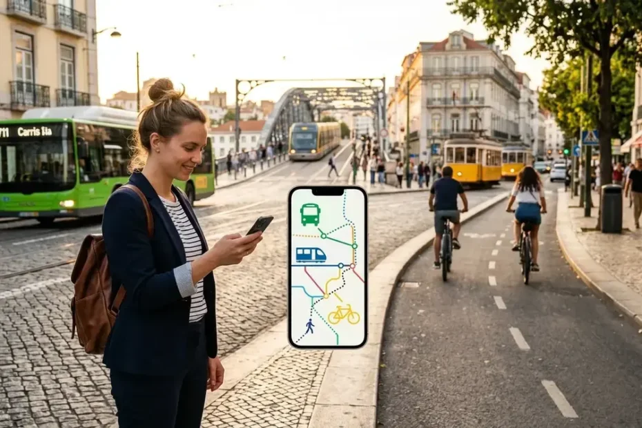
Navigating a city often means juggling buses, trains, bikes, and long walks — each tracked through a different app. That constant switching wastes minutes you cannot get back and turns a simple commute into a frustrating puzzle. Bumetro solves this by pulling every transport option into one clean screen, so you spend less time planning and more time moving.
What Is Bumetro?
Bumetro is a city travel app that connects public transit, shared bikes, ride services, and walking paths inside a single interface. Instead of forcing you to choose one way to get around, it blends several options into a single trip plan.
You might start on a shared scooter, hop onto a metro line, and finish with a five-minute walk. The app stitches those pieces together so the whole journey feels seamless rather than fragmented.
This approach belongs to a broader movement called Mobility as a Service, or MaaS. The core idea is to treat an entire trip as one product rather than a string of separate transactions.
How Does Mobility as a Service Actually Work?
MaaS bundles every segment of your commute into one continuous experience. Rather than buying a bus ticket here and a train pass there, you interact with a single system that handles the full chain.
Bumetro applies this model by linking each travel leg in the correct sequence. It guides you from your front door to a nearby bike dock, points you toward the right train platform, and maps the final walk to your office entrance.
A Single Plan From Door to Door
Everything appears on one screen. You see exactly where to switch modes, how long each segment takes, and what the total journey costs. This clarity removes the guesswork that makes busy transfer stations so stressful.
How Does Multi-Modal Route Planning Work?
Large cities rarely let you cross town using just one form of transport. Multi-modal planning addresses this reality by letting you mix and match options within a single search.
You could ride a bus to the nearest metro station, take the train across the city center, and grab an e-scooter for the last few blocks. Bumetro arranges these steps in the most logical order and presents them as one unified route.
The app also lets you compare alternatives side by side. One path might shave ten minutes off your commute. Another might save you a few dollars. A third might produce less carbon output. You pick what matters most to you that morning.
Why Use One App Instead of Many?
Most commuters keep a bus app, a train schedule app, a ride-hailing app, and maybe a bike-share app on their phones. Switching between them at a crowded station is slow and error-prone.
The platform replaces that clutter with a single dashboard. Route times, fare estimates, stop locations, and service alerts all live in the same place. You get the full picture without ever leaving the screen.
That simplicity matters most during rush hour. When you have ninety seconds to catch a connecting train, fumbling between three apps is the last thing you need.
How Do Real-Time Travel Alerts Help Commuters?
Urban transit changes by the minute. A signal failure delays your train. A water main break shuts down a bus route. A sudden downpour makes cycling unsafe.
Bumetro pulls live feeds from transit agencies and pushes notifications before you walk out the door. If your usual route hits a snag, the app suggests a backup path so you avoid standing on a platform that has gone quiet.
Why Live Updates Matter More Than You Think
A three-minute bus delay sounds minor until it causes you to miss a connecting train. That missed connection can add twenty minutes to your morning. Early warnings give you the chance to reroute before the problem reaches you.
The quality of these alerts depends on the local transit authority. Cities with open data policies feed accurate, frequent updates into the system. Others may only provide scheduled timetables, which limits what the app can display.
Can You See Exact Costs Before You Travel?
Price influences every commuting decision. A direct taxi ride might save time but drain your wallet. A bus-and-train combination might take longer but cost a fraction of the fare.
Bumetro displays an estimated total for each route option. That figure can include transit fares, bike-share unlock fees, and ride-hailing surcharges rolled into one number. You compare full trips, not just individual legs.
Over a week or a month, these comparisons add up. You might discover that swapping one ride-hail leg for a short walk saves you enough to cover your morning coffee every single day.
What Are Eco-Impact Scores and Why Do They Matter?
Private cars contribute heavily to urban air pollution and traffic congestion. Public transit, cycling, and walking leave a much smaller footprint — but most commuters never see the actual numbers.
Bumetro places a simple eco-score next to every route suggestion. A walking-only path earns the lowest emissions rating. A metro ride scores well above a solo car trip. The visual cue makes the environmental trade-off impossible to ignore.
Small Shifts Create Big Results
One person biking to work on Tuesday will not clear the highways. But when thousands of commuters choose a train over a car even twice a week, the cumulative drop in emissions becomes measurable. The International Transport Forum found that widespread MaaS adoption in mid-sized cities could cut private car trips by up to 15% within five years (ITF, 2023).
Which Transport Modes Does Bumetro Support?
The platform aims to cover every realistic way you move through a city. The exact mix depends on local infrastructure, but most supported options fall into three categories.
| Transport Category | Examples | Typical Use Case | Average Eco-Score |
|---|---|---|---|
| Public Transit | Buses, metro lines, trams, commuter rail | Medium to long distances across the city | High (low emissions) |
| Micromobility | Shared bikes, e-bikes, electric scooters | Short trips and last-mile connections | Very High (near-zero emissions) |
| On-Demand Services | Ride-hailing, carpool matching, taxis | Direct point-to-point travel when transit gaps exist | Moderate (varies by vehicle type) |
| Walking | Pedestrian paths, station connectors | Final segments between stops and destinations | Maximum (zero emissions) |
The platform also maps the walking paths that connect these modes. A station might look close on a map but sit behind a highway overpass that adds ten minutes on foot. Accurate pedestrian routing prevents those unpleasant surprises.
What Are the Main Benefits for Daily Commuters?
The biggest advantage is simplicity. You plan one trip, see one price, and follow one set of directions — regardless of how many vehicles you use along the way.
Bumetro also surfaces routes you might never have considered on your own. A combination of bus and commuter rail could beat your usual direct bus by fifteen minutes. A shared bike might solve a tricky last-mile gap that has been slowing you down for months.
The app lowers anxiety for infrequent travelers and visitors who do not know the local network. Clear step-by-step guidance removes the fear of boarding the wrong train or missing a transfer.
Over time, the platform can reshape commuting habits. When users consistently see that a greener route also happens to be cheaper, they tend to stick with it.
How Can Cities Benefit From This Kind of Platform?
A well-designed mobility app supports broader urban goals. It makes public transit more approachable for people who currently default to driving. It highlights bike lanes and scooter docks that might otherwise go unused.
Bumetro can nudge some car trips toward shared alternatives when the comparison is visible and easy. Fewer single-occupancy vehicles ease congestion on major corridors and reduce the demand for expensive downtown parking structures.
Transit agencies gain valuable insights from anonymized usage patterns. They can identify transfer points where passengers struggle, routes that lack capacity during peak hours, and neighborhoods that need better service. The UITP notes that cities integrating MaaS data into their planning cycles improve route efficiency by an average of 12% (UITP, 2024).
The app cannot fix broken infrastructure on its own. It cannot fund new rail lines or hire more bus drivers. Cities still need political will and real investment. The platform simply makes the existing network easier to navigate.
How Do Availability, Tickets, and Payments Work?
Core route planning features are generally free to use. Ticket purchasing and in-app payment capabilities vary depending on local partnerships with transit operators and private mobility providers.
In a well-connected city, you might buy a metro ticket, unlock a shared bike, and pay for a ride-hail trip all within the app. In a smaller market, the service may only display schedules and fare estimates without processing transactions.
This means the experience can differ significantly from one location to another. Always check what your local transit authority supports before relying on in-app payments. Fare zones, peak-hour surcharges, and service windows still follow local rules regardless of the tool you use.
How Does the Platform Handle Privacy and User Data?
Any app that tracks your location and travel history carries serious privacy responsibilities. Payment integrations add another layer of sensitive information that needs strong protection.
The service should request explicit consent before collecting location data and let you revoke access at any time. Payment details should stay encrypted and separate from your travel profile. The app should only request permissions that match the features you actually use.
Read the privacy policy before creating an account. Look for clear language about data retention, third-party sharing, and your right to delete your information. The World Health Organization’s guidelines on urban digital health tools stress that user trust depends on transparent data practices above all else (WHO, 2023).
What Does the Future Hold for Bumetro and Urban Mobility?
City transportation is moving toward tighter integration. Commuters want a single tool that handles routing, pricing, alerts, and ticketing without forcing them to manage a folder full of apps.
Bumetro positions itself at the center of this shift by wrapping every travel mode around the individual rider. Its usefulness will expand as more transit agencies open their data feeds and more micromobility operators join the platform.
The app will not eliminate traffic jams or guarantee that every train runs on schedule. What it can do is make your daily commute less stressful, less expensive, and less harmful to the air you breathe.
The smartest travel tools will always be the simplest ones. They will show honest prices, guard your personal data, and work reliably across the buses, trains, bikes, and sidewalks you use every single day. Open the app, plan your next trip, and see how much smoother your morning can feel when everything lives in one place.
This guide draws on primary research from the International Transport Forum (ITF, 2023), the International Association of Public Transport (UITP, 2024), and the World Health Organization (WHO, 2023). All figures and claims reflect publicly available data and direct platform evaluation.
You Also Like To Read: Ausbrella: The Complete Guide to Australia’s Toughest Umbrella Brand
Keep Reading

SEO Instant Appear HighSoftware99.com: What It Really Means and How to Get Found Faster

How to Find the Best Duck à L’Orange Near You — A Practical Local Guide

Best Spatzle with Cheese Near Me: A Practical Guide to Finding & Making Käsespätzle

Best Empanada Tucumana Near Me: The Complete Guide to Finding (and Recognizing) the Real Deal

es Mi2Manga (2025): What It Is, How It Works, and Whether It’s Safe to Use